

Precision farming is all about using modern technologies and equipment in agriculture. The OneSoil team have developed a custom precision farming platform and released several devices, which tech-savvy farmers can use to remotely monitor crop performance, soil and air conditions, and manage the application of seeds and fertilizers more efficiently.

The Scope
Demonstrate the platform's capabilities to farmers and get them to use it.
How It Works
The platform is a complex product, as it taps satellite imagery, big data and neural networks.

We've decided to take it easy on the farmers during their first experience with the platform, without overwhelming them with figures and technologies. So we start off by discussing fields, fertilizers and weather instead.


Animated stories are an easy-to-digest way to explain how to handle the platform — perfect for an introduction.

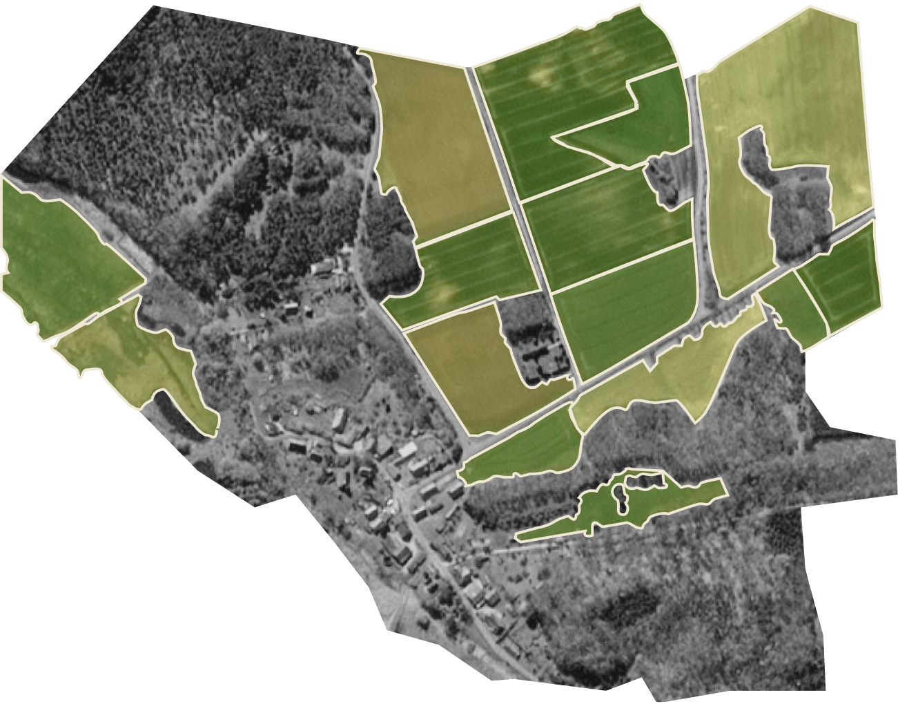
To start working with the platform, all the user has to do is click on highlighted frame borders to mark the location of their fields on the map. This opens access to the platform's key tools:
— Scouting and notes;
— Weather;
— Fetilizers.
— Weather;
— Fetilizers.
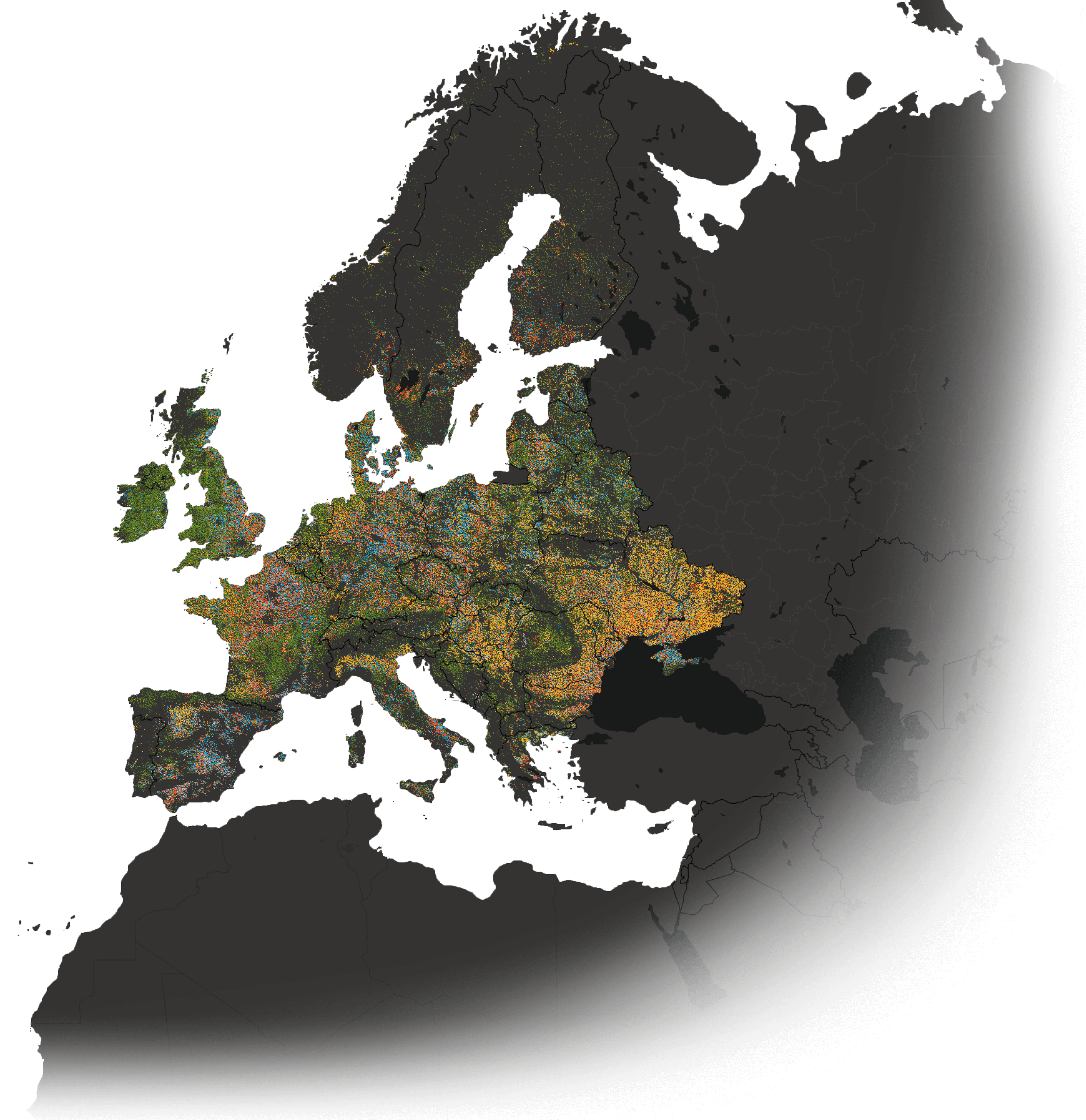
In 2019, OneSoil delineated fields all over the world and detected some of the main crop types

Scouting and Notes
The platform tracks plant development via the changes in the NDVI (normalized difference vegetative index). This indicator shows a plant's health based on how it reflects sunlight.


OneSoil analyzes satellite imagery to automatically calculate the NDVI index.
If the farmer sees varying NDVI values on different areas within a field on the map, then it's a call for them to get out into the field to check the problem area and find out what's wrong. Or leave a geo-located note with a photo of that area which can be instantly shared and collaborated on with colleagues.
If the farmer sees varying NDVI values on different areas within a field on the map, then it's a call for them to get out into the field to check the problem area and find out what's wrong. Or leave a geo-located note with a photo of that area which can be instantly shared and collaborated on with colleagues.
There are 3 basic usage scenarios for the NDVI index:
— at the beginning of the season, it allows to understand how the plants have survived through the winter;
— in the middle of the season, it helps keep track of how they grow and develop;
— at the end of the season, it allows to determine which fields are ready for harvesting.
— in the middle of the season, it helps keep track of how they grow and develop;
— at the end of the season, it allows to determine which fields are ready for harvesting.


Satellite images of the same field through the year
The farmer can pinpoint abnormalities in a particular field area by looking at the change of its color on the map and quickly fix the problem.


Fertilizers
Based on the NDVI index, the system can determine the necessary fertilizer doze for each zone of the field. On the map, the user can see the current picture of their fields, with different zones marked in one of three colors — from yellow for the ones in the most need of fertilizing to green for the healthiest ones.


The OneSoil platform uses this data to generate a file with a special task for differentiated fertilizer application. The file can be downloaded to a flash drive and transferred to the tractor onboard computer.
of fertilizers are saved by OneSoil clients
up to 30%
OneSoil Design System
OneSoil is one of the companies who appreciate the value of designer solutions. So they didn't come to us empty-handed and already had their own.
Logo

Brand color
Crayola Green

#28AC61


Font


Belarusian scenery photos, captured by OneSoil cofounder Slava Mazai


Check out his Twitter for more amazing drone shots
This nice starting point inspired us to create a recognizable и vibrant style for the website that should make OneSoil's brand image stick in the visitors' memory. We have produced three groups of branding materials:


Expressive vector iconographics


Original Illustrations by Daria Sazanovich
Deeply retouched object photography
OneSoil Weather Sensor and Modem
OneSoil offers an integrated solution which includes apps and equipment — a modem and a weather station. These gadgets help the farmers gain a better understanding of a number of soil measurements and manage their agricultural machinery for spreading fertilizers more accurately. The sensors gather and send more precise and real-time field data to OneSoil's cloud-based service which the team uses to refine their analytics and predictions algorithms.

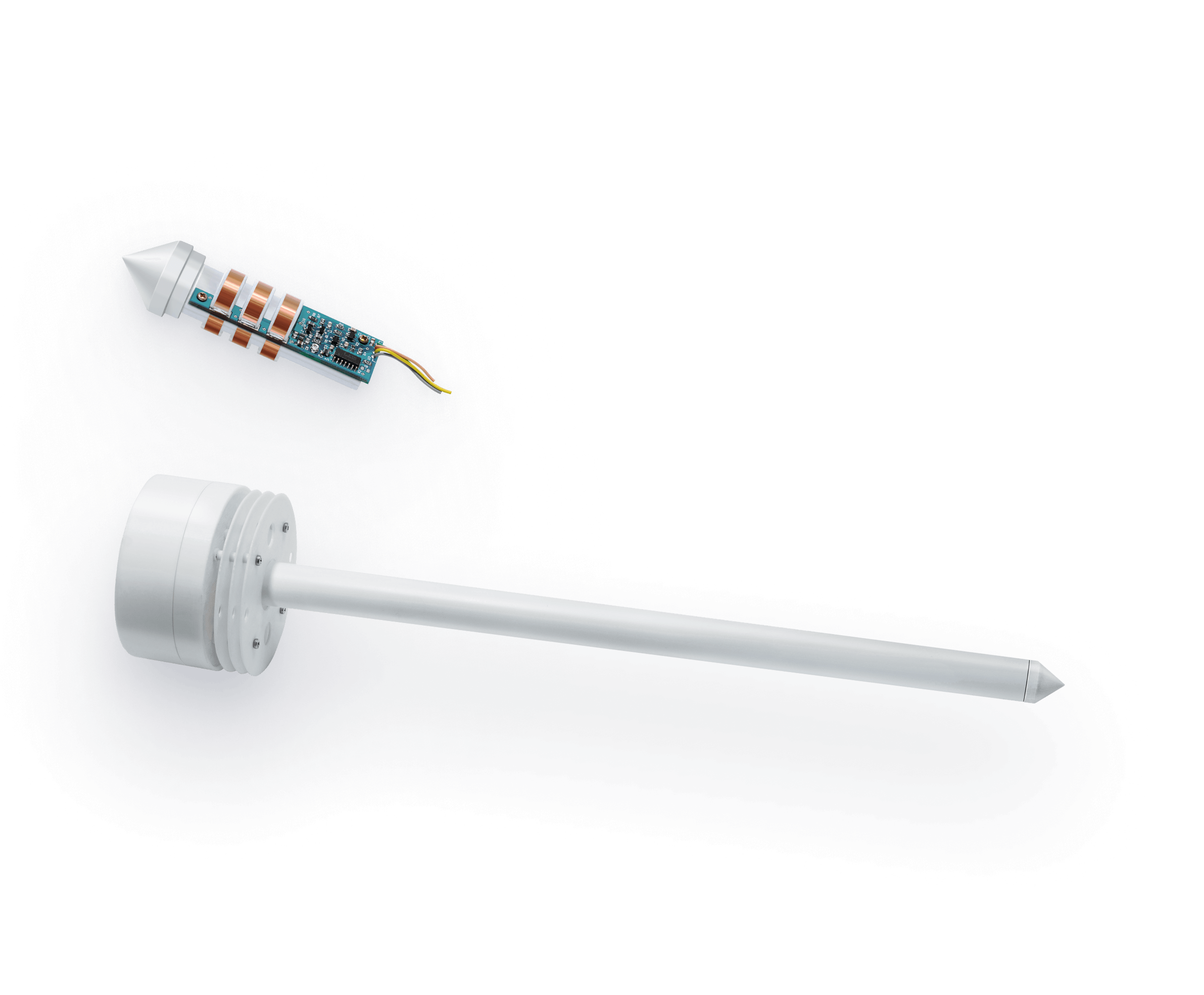
The weather sensors measure the level of light intensity across parts of the field, soil moisture, air humidity as well as both soil and air temperature.
The Weather Sensor
The data is sent to the cloud every 1-2 hours via mobile internet connection. The device is powered by classic АА batteries that last for a season and can normally collect data from 25 hectares of land.
The sensor was developed in-house by the OneSoil engineers. Just to provide the users a sneak peek into the device, we've given a close up of its various components.
The sensor was developed in-house by the OneSoil engineers. Just to provide the users a sneak peek into the device, we've given a close up of its various components.


The Modem
The farmers can use the modem to remotely monitor the agricultural machinery's operation in the fields and control fertilizer application rates. The aggregated information is displayed on a map which shows vehicle routes, gaps and overlaps. This allows to adjust fertilizer dozes in problem areas on the spot and without harming the plants.

Other devices of the same class currently available in the market cost thousands of euro. OneSoil developers want to create modems at a fraction of the cost.
Better and cheaper
The modem has a built-in GPS-navigator to identify the machinery's location on the field


The Neural Network
We have deliberately left the most important ingredient of the platform for when the users have got acquainted with the apps and gadgets.
The model trained on tens of thousands of images is by far the most powerful part of the whole platform. The system can analyze satellite data, field sensor data and manual input by the farmers. All of this is used for real-time detection of field borders, crops and plant growth stages. This already looks mind-blowing, but soon the AI will add more advanced features like the prediction of plant diseases, crop yield or the emergence of pests.
The model trained on tens of thousands of images is by far the most powerful part of the whole platform. The system can analyze satellite data, field sensor data and manual input by the farmers. All of this is used for real-time detection of field borders, crops and plant growth stages. This already looks mind-blowing, but soon the AI will add more advanced features like the prediction of plant diseases, crop yield or the emergence of pests.
The neural network can detect and filter out clouds, their shadows and snow.


We have turned to charts instead of walls of plain text and tried to find ways to make the most important facts and figures more prominent, so that the reader can easily get the idea behind each the tech even if they are just quickly scanning the page.
Large scale lettering to show off the most noteworthy and useful data points


Emphasis on the scale of the project: the team spent just 2.5 years for a task that would take one person 49 years at a stretch — without a break for sleep or rest — to complete manually.


The Team
Investors need not only to know about the technology itself, but also about the people who make the project happen. So we round it all up with the story behind OneSoil, its team and corporate structure.


We've turned to the suprematism style, which builds upon a play of shapes and color, to make the interactive field & crops map more engaging for the readers.
HypeSoil
OneSoil is building a cool product, and their stories get you glued to their blog. And this global farming map project has got a lot of public attention, too: 1.5K "likes" on Product Hunt, coverage by famous designers and a bronze prize in the Maps, Places & Spaces category of the Information is Beautiful Awards 2019.


